
Walking a San Diego County Street
A useful street directory search is a short chain of custody. Start with the normalized situs address. Find the parcel number in the secured assessment roll or ParcelQuest, then place that APN on the SanGIS map. Ask Assessor Public Information for the owner and mailing address by phone or use an ARCC office kiosk. Next, search the current owner in the Recorder’s Official Records Index, record the acquisition deed, and follow the seller backward when the goal is history. Add permits for dated work and a reverse directory for older occupants.
That chain moves from geography to identity and then to time. Do not treat a parcel as a household. The situs address marks land. The mailing address receives tax correspondence. A legal description identifies the title interest across a street-number change. A permit names an applicant, owner, or contractor connected to work. A voter file is restricted and cannot be used as an unrestricted block roster.
- Enter the street number and name, then save the matching APN and assessment result date.
- Open SanGIS, select the parcel, and note adjoining APNs, jurisdiction, subdivision, lot, and map references.
- Call 619-236-3771 or visit an ARCC kiosk for owner and mailing-address information.
- Search the owner as a grantee, locate the acquisition instrument, and identify the earlier grantor.
- Use permits, city or county planning files, directories, and newspapers only for the question each can answer.
When a name search becomes the main task, switch to the San Diego County resident lookup workflow. When the goal is the full backward trail of one house, use the previous-residents route instead of treating current street results as history.
San Diego County Street Records
Several record sets can be walked street by street, but they do not carry the same evidence. The secured roll can match a street name and return assessment information without exposing owner names online. SanGIS supplies parcel shapes and available boundary layers. Recorded documents identify parties and dates. Permit and plan files add an address-dated project trail. Reverse directories supply historical occupants, including some people who did not own the property.
| Record set | Address clue | Keeper | Access |
|---|---|---|---|
| Secured assessment roll | Address, street name, APN, values | ARCC Assessor | Free web search; owner by phone or kiosk |
| Parcel map | Lot lines, dimensions, adjoining parcels | ARCC and SanGIS | Map viewer and kiosk |
| Official Records Index | Recorded parties and instruments | ARCC Recorder | Free name/document index, 1970 forward |
| Permits and plans | Project address, APN, applicant, dates | City or County custodian | Portal, review appointment, or request |
| Reverse directories | Address-to-occupant entries by year | San Diego Public Library | Physical collection or selected digital scans |
Ownership is strongest when a recorded deed and legal description agree with the current custodian. Occupancy is more modest. A directory entry is a dated publication clue, and a homeowner exemption is a claimed tax status rather than a complete resident count. Rely on the source that is closest to the claim.
San Diego County Assessor Search Fields
The secured roll provides three useful entry modes: parcel number, address, and street name. A full APN can look like 123-456-78-90, while the research notes that a minimum of eight digits can work in the parcel field. Address search needs the street number and name. Street-name search is the way to browse matching assessment entries when a researcher wants to walk a stretch rather than open one lot.
| Field | Type | Required | Format |
|---|---|---|---|
| Parcel Number | Text | One of three keys | 123-456-78-90; minimum eight digits noted |
| Address | Text | One of three keys | Number and street name |
| Street Name | Text | One of three keys | Browse matching street entries |
| Search | Button | After a key | Returns current assessment information |
The public assessment display shows assessed values and exemptions but withholds ownership online under the cited California restriction. That is why an online hit cannot finish a street directory search. Assessor Public Information gives ownership and address information at 619-236-3771, and office kiosks add ownership, values, maps, sales listings, characteristics, and historical tax information. The Treasurer-Tax Collector property-tax search supplies APN-linked tax-bill and payment-status context.
See the San Diego County secured-roll search before changing spelling or stripping a directional from an address. Preserve the exact returned address as a citation clue.
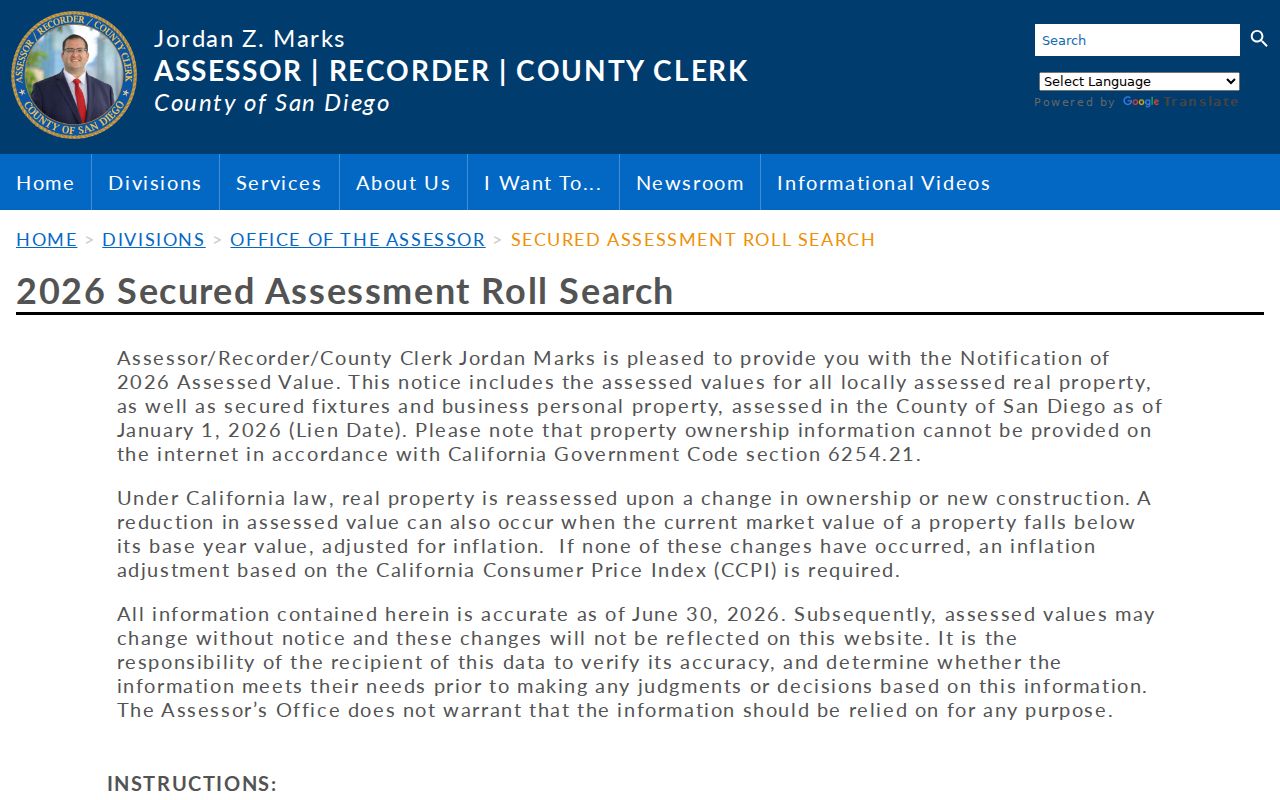
The assessment form demonstrates the three address-keyed entry paths and the online ownership limit that sends a complete lookup to a phone or kiosk channel.
San Diego County Parcels in SanGIS
SanGIS supplies the map step between an address and its surrounding lots. Search by address or APN, turn on parcel and jurisdiction layers, zoom to the street segment, and use identify or click to read the selected feature. Layer availability can vary, so write down what was visible and the date of the map view. The map can show adjacency, but it cannot tell who sleeps in a structure.
- Parcel
- A mapped land unit identified by an APN, not a list of all people connected to it.
- Situs address
- The location of the land or structure. It may differ from the mailing address used for tax notices.
- Plat or recorded map
- A filed map that gives subdivision or lot context and can help preserve continuity when a number changes.
- Criss-cross directory
- A directory arranged by street or address, allowing a reader to move from a place to names.
The SanGIS Interactive Map is free. Use it for place and boundary context, then return to ARCC for owner identity and the Recorder for title evidence. A map selection becomes more useful when paired with the APN, legal subdivision, lot, and recorded-map reference.
For the vendor-assisted parcel view, open the ParcelQuest entry and limits before relying on a report.
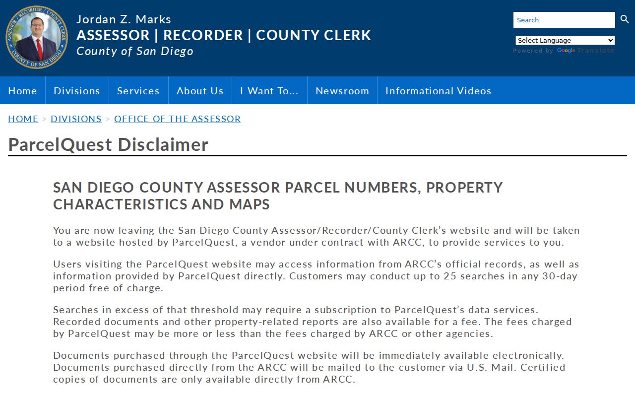
ParcelQuest can expose APNs, characteristics, and maps, but its free use is limited to up to 25 searches in a rolling 30-day period and its vendor reports may carry separate prices.
San Diego County Deed Chain Since 1970
The Official Records Index is the main recorded-document trail from 1970 forward. Search a grantor or grantee name, narrow by document type or recording date, and save the document number. A grantor is the party conveying an interest. A grantee is the party receiving it. Those roles change from one transaction to the next, so a backward chain starts with the current owner’s acquisition and then searches the seller as an earlier grantee.
The web index is not a deed image and does not summarize every covenant or consideration. Images can be viewed at public kiosks, and copies can be ordered from ARCC. Certified copies come from the county, not a vendor. The Recorder’s APN search was removed from the public web interface on December 9, 2024 under AB 1785, but APN searches remain at five ARCC office kiosks.
- Search the current owner by grantor or grantee name and narrow a common name by date.
- Open the likely acquisition entry and compare the document number, recording date, legal description, and parcel clues.
- Record the seller or grantor, then search that party as a prior grantee.
- Repeat only when the legal description supports the same parcel, not merely the same street name.
- Move to counter indexes, deed books, microfilm, or archives for years before the online span.
For a named street, the full street directory is a current-record chain; the deed index supplies title events, not a list of occupants.
Read the ARCC recording and Official Records instructions before opening the index image or requesting a copy.
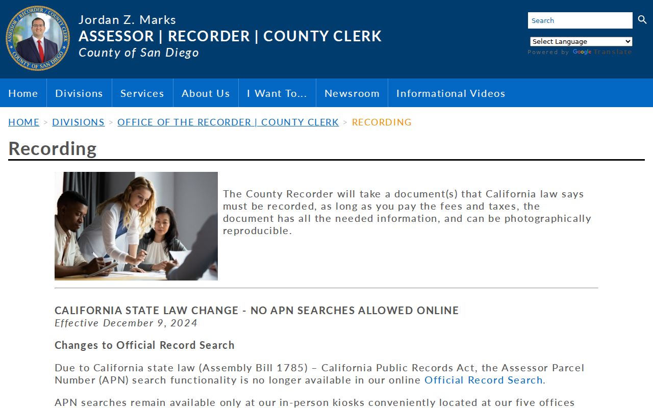
The ARCC recording instructions show the grantor-grantee search route and the recent change that makes kiosk access important for an APN-first search.
San Diego County Permits by Address
Permit and plan records add dates to a street directory search. City of San Diego Development Services keeps building permits, plans, inspections, zoning files, and project records. The modern Zoning and Permit Portal and older Permit Finder or PRIME links are address or project keyed. A permit can name an applicant, owner, contractor, job address, scope, valuation, issue date, final date, and status. It proves an association with a property or project, not residence.
Older paper plans may require a Records Review appointment or a California Public Records Act request. A request should name the department, address or APN, project number, date range, record type, and preferred format. The incorporated city matters. Another city in San Diego County may hold its own permit and code files, while an unincorporated address routes to County Planning and Development Services.
Open the City of San Diego development records route for the city’s portal, review, and request paths. For a non-exempt existing city record that is not posted, use the City public-records request portal. Keep permit evidence separate from deed evidence and from household evidence.
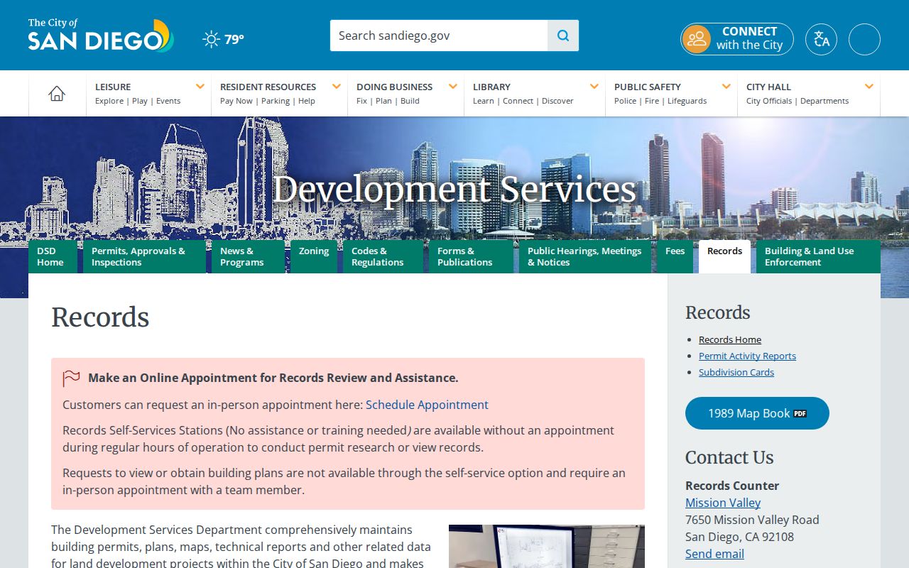
The permit-record view is useful because it ties a project to a place and date, while the custodian’s own record remains the authority for status and copies.
San Diego County Owner Alert
Owner Alert watches future recordings for up to ten monitored names and ten APNs per email. It is useful after a street address has been resolved to a parcel, but it cannot reconstruct prior residents or validate a document. The message gives a document number and index link. Open the official index, compare the parties and legal description, and request the record from ARCC if the document itself matters.
ParcelQuest and county copies also differ. ParcelQuest can provide an immediate electronic vendor document or report, while direct county copies are mailed and certified copies are county-only. Vendor pricing and county fees are separate. A paid delivery is not stronger evidence merely because it arrives sooner.
The Owner Alert service is best treated as a pointer into a San Diego County street directory workflow, not as a finished finding.
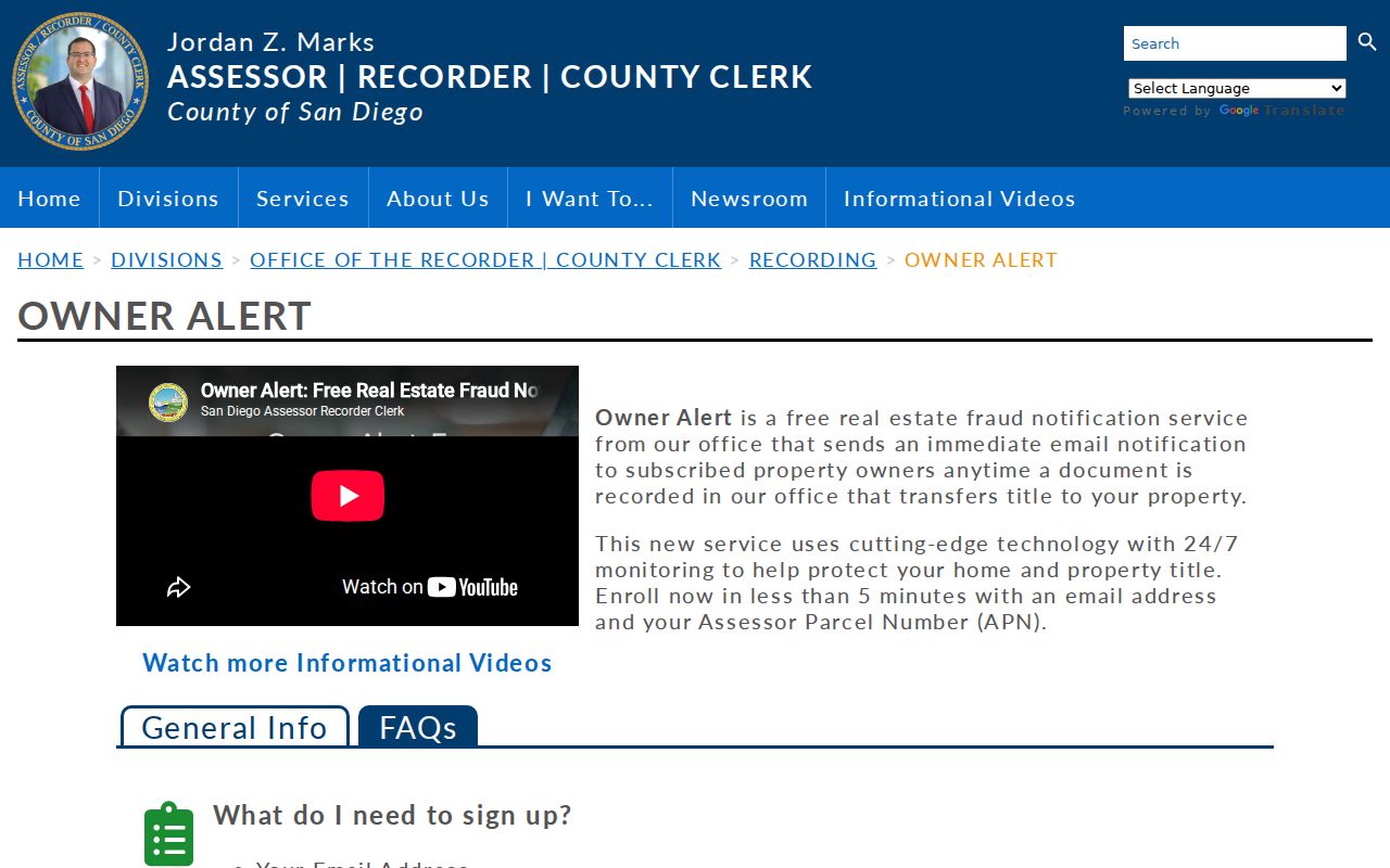
The alert interface reinforces the need to verify the document number and indexed parties before drawing a conclusion about a parcel.
San Diego County Reverse Directories by Street
Historical reverse or criss-cross directories change the direction of the search. Instead of starting with a surname, locate a street and number in the address section, then record the printed occupant, household notation, business entry, and page. San Diego Public Library Special Collections describes a physical city-directory run from 1886 through 2021, while selected digitized volumes cover 1874 and 1926 through 1960. The volume’s title page and abbreviation key should be cited.
Do not assume that a street number stayed fixed. Search nearby numbers, street-name variants, and the reverse section when an entry disappears. Sanborn maps, City B and C sheets, deeds, and permits can explain a renamed road, a new structure, or a subdivision change. A directory entry is a dated clue to an occupant, not a complete list of household members.
The historical shelf belongs to the San Diego County city directories page, where the year runs and entry-reading method sit together. The street directory uses the reverse section only when the address question needs a past name.
San Diego County Address Changes and Jurisdiction
San Diego County has no single street grid. Downtown numbered and lettered streets, beach communities, former towns, subdivisions, and unincorporated areas developed with different patterns. A postal “San Diego” label can also describe land outside the City of San Diego. For a permit or code case, confirm the incorporated city or county jurisdiction in SanGIS before sending a request.
The APN and legal description are the durable bridge. A street number may be renumbered, a road may change name, and a boundary may move while the parcel identity and recorded map continue to connect the sources. Use the assessment map to find the APN, a deed to test continuity, and a Sanborn map or historical directory to understand how an old address was printed.
Rural mountain and desert routes make the distinction sharper. One ZIP can cover a large area, and a mailing description may not match the situs or title description. Keep postal geography, civic jurisdiction, parcel identity, and historical address as four separate notes.
San Diego County Street Directory Limits
A street directory cannot show every neighbor or household in San Diego County. The assessment roll is not an occupant list. Voter addresses are confidential to the general public. Utility, delivery, DMV, and customer records are not substitutes for a public address index. Other occupants, children, and household members may be absent from property and directory records. A common name can also make a deed or court hit look stronger than it is.
California stalking and harassment laws still apply when a fact came from a public record. Penal Code section 646.9, Penal Code section 653m, and Code of Civil Procedure section 527.6 set serious boundaries around threats, unwanted communications, and civil harassment. Safe at Home and other confidentiality rules may lawfully hide an address. Do not try to rebuild a protected address through unrelated sources.
When the record trail ends, note the exact stopping point. A careful negative result says which portal, date range, jurisdiction, spelling, and access channel were checked. That is more useful than claiming that no one lived at an address.